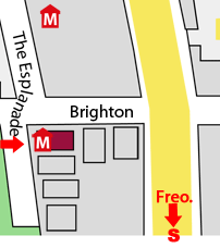
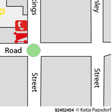
Scarborough Map

Detailed interactive: Scarborough Map
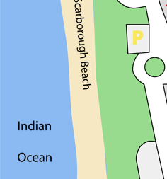
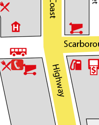
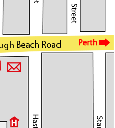
Zoom to Scarborough Street level by dragging a pink square over the Streets of Scarborough you're interested in.

Scarborough Beach map WITH hotels pinned*.

Download 1.3mb PDF map of Scarborough Beach

Perth Map

scarborough beach, perth western australia
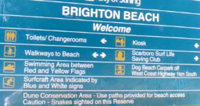
Click on business location to link to their site.  Map not to scale.

BOUNDING COORDINATES

North: -32.8917
West: 115.675
East: 115.675
South: -32.8917
Brighton Beach
Brighton Beach Australia is south of and
next to Scarborough Beach.
map Scarborough beachmap of Scarborough Beach
Scarborough Beach Map
Street map of Scarborough Beach

Getting Here From Perth International Airport:

  1. Horrie Miller Drive
  2. Right into Tonkin Highway
  3. Left into Great Eastern highway towards Perth  <<<< From Perth Domestic (inter state) Airport
  4. Graham Farmer Freeway / Tunnel
  5. Mitchell Freeway.
  6. Powis Street off ramp.
  7. Sanders Drive around northern side of Herdsman lake.
  8. Right into Selby Street
  9. Scarborough Beach Road west past Innaloo shopping complex leads straight to Scarborough Beach.

The Scarborough CBD has a lot of pedestrians, especially in summer.
In Western Australia, turning traffic MUST give way to pedestrians.

scarborough map

Scarborough accommodation managers can add their pin location on the zoomable Scarborough Street Map
Register for free 
Call Ben on 0418958799 for a free consultation if you want help pining your business on the the maps above.

Top Map of Scarborough